The Coves and Points of the Palos Verdes Peninsula By Photographer and Contributor Michael Nyiri

Although I don't live on the Palos Verdes Peninsula, I have always called it "my backyard". I've been taking frequent drives around "my backyard" since I moved to the South Bay in 1975. I know the coastline of the Peninsula very well. I've never surfed, but I've hiked much of the perimeter down by the water, checking tide tables to make sure I don't get caught without an exit back up the cliffs. The coves and points which make up this perimeter have been a steady subject of my photography for many years.
My photography hobby really began to grow when I discovered HDR processing in 2015.
I like to travel, and am now retired, so I take photos everywhere I go. I've had plenty of chances and love to take the time to get out and about on my drives around "my backyard" to take photos of the many inlets, coves, and points on the rocky shores of the Palos Verdes Peninsula.
Here is a tour, beginning at Malaga Cove and ending at Point Fermin. Some of the coves are "tourist friendly" with parking lots and trail maps and some are almost hidden from view, known as local surf spots. All are beautiful and special to the residents of the Peninsula and to those of us who consider our "backyard" a great place to breathe in the wonder of the great Pacific Ocean pounding up against the rocky cliffs of Southern California's Palos Verdes Peninsula.
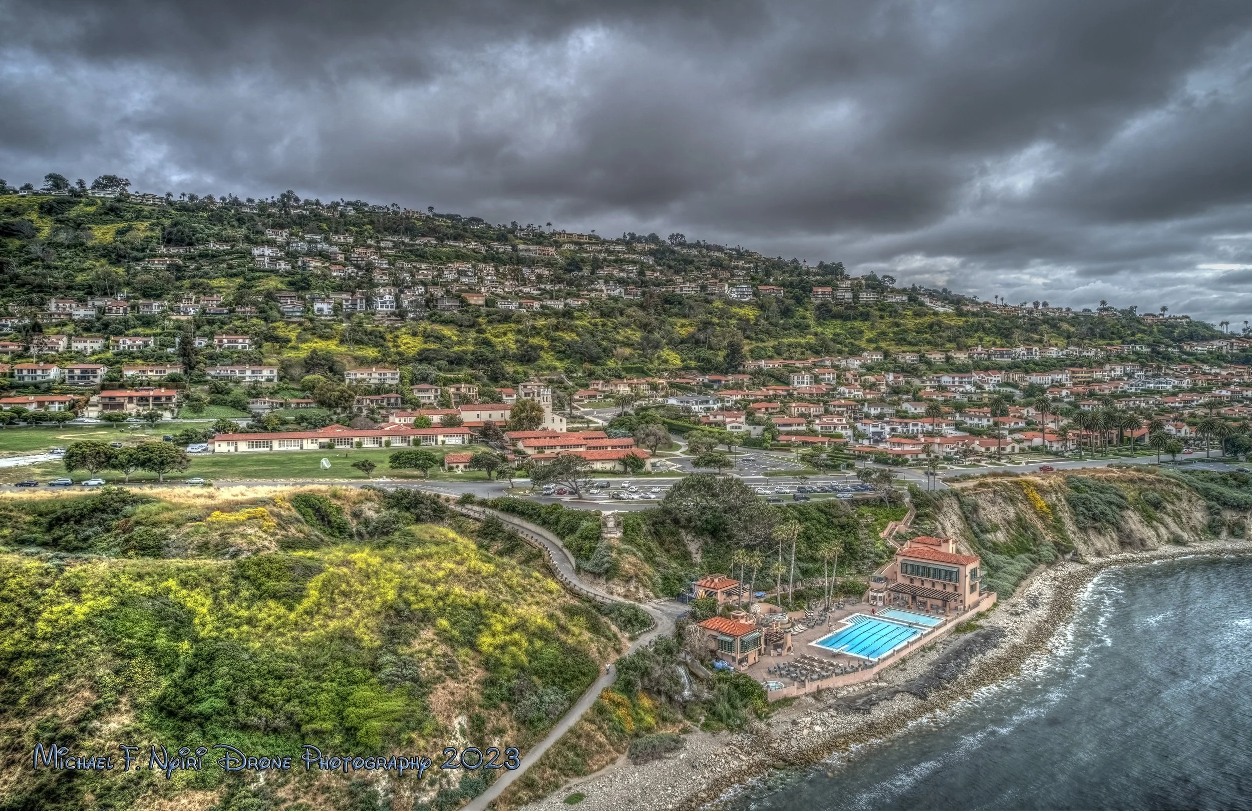
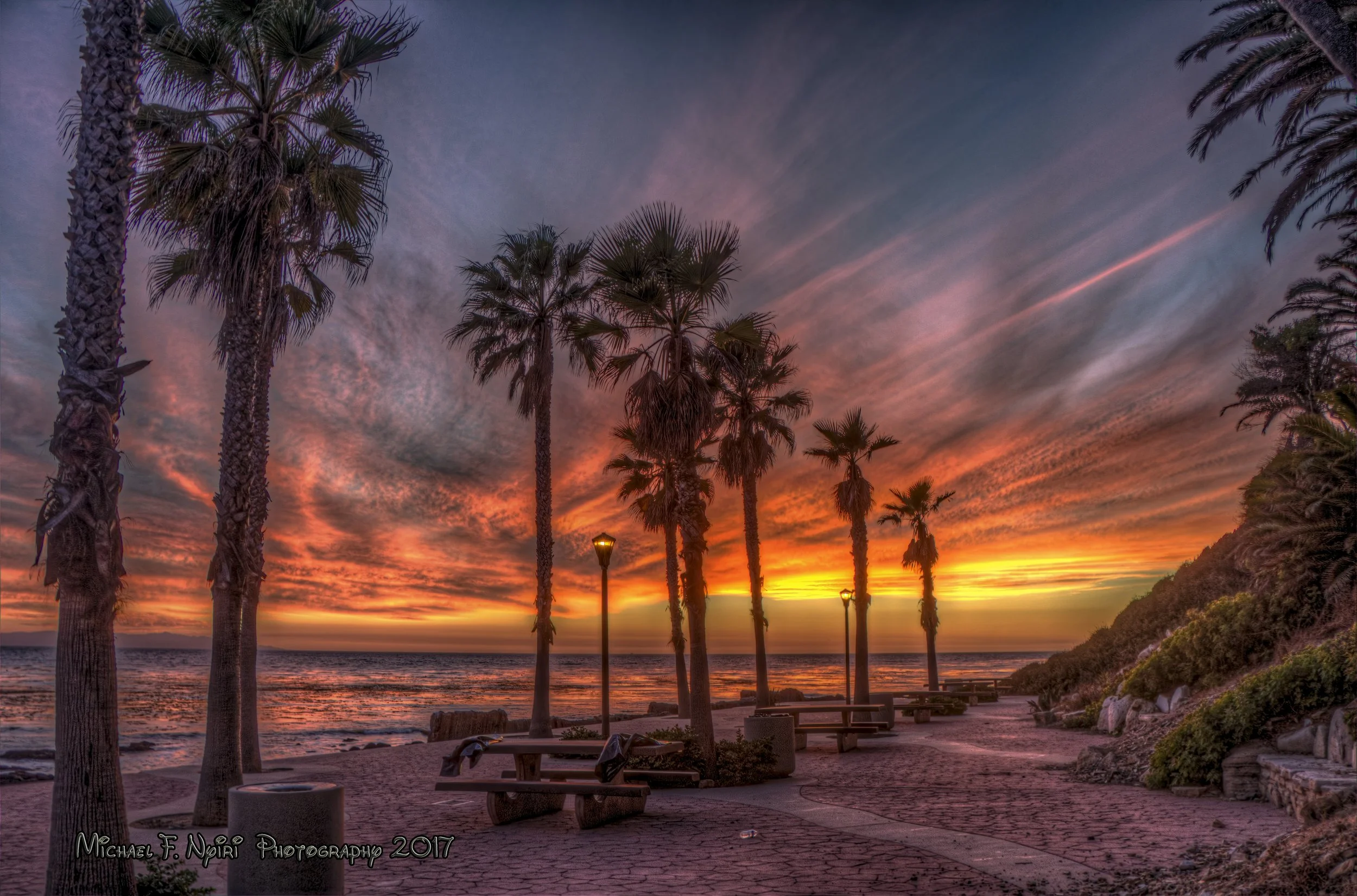
Malaga Cove - Roessler Point
"Amazing Evening" 10-22-2020
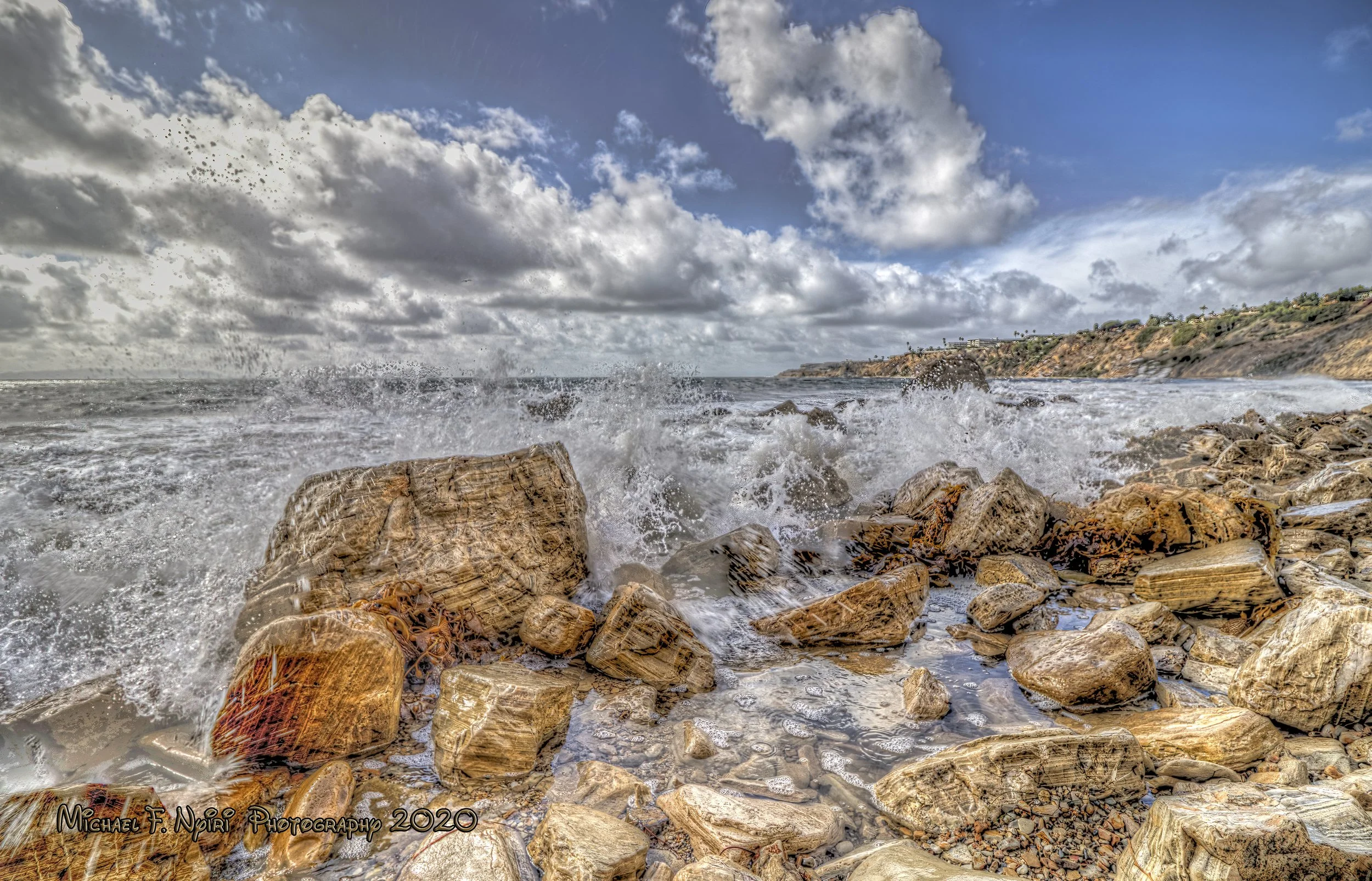
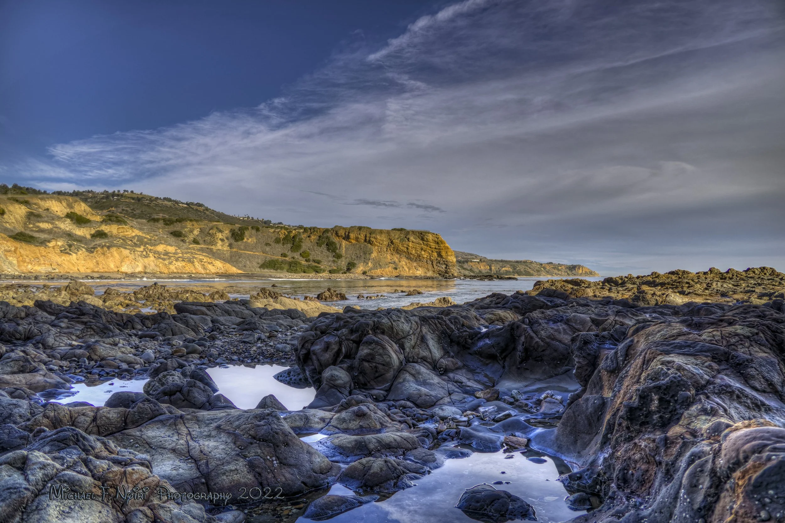
There aren't a lot of sandy beaches among the coves of the Peninsula. On the north, Torrance Beach morphs into RAT beach. (either an acronym for "Right After Torrance" or possibly named for a surfer's pet rat.) Torrance is the last really "sandy" beach and RAT has a bit of sand but the rocks begin right before Malaga Cove, which begins at Roessler Point with a runoff waterfall at the end of the trail from the Malaga Cove School near the gazebo and stretches around to Flat Rock Point and Bluff Cove.
The Palos Verdes Beach & Athletic Club is on the left after you get down to the ocean. You can ford the runoff from the waterfall and hike around to Bluff Cove.
"Above Roessler Point" 05-20-2023
Bluff Cove - Flat Rock Point
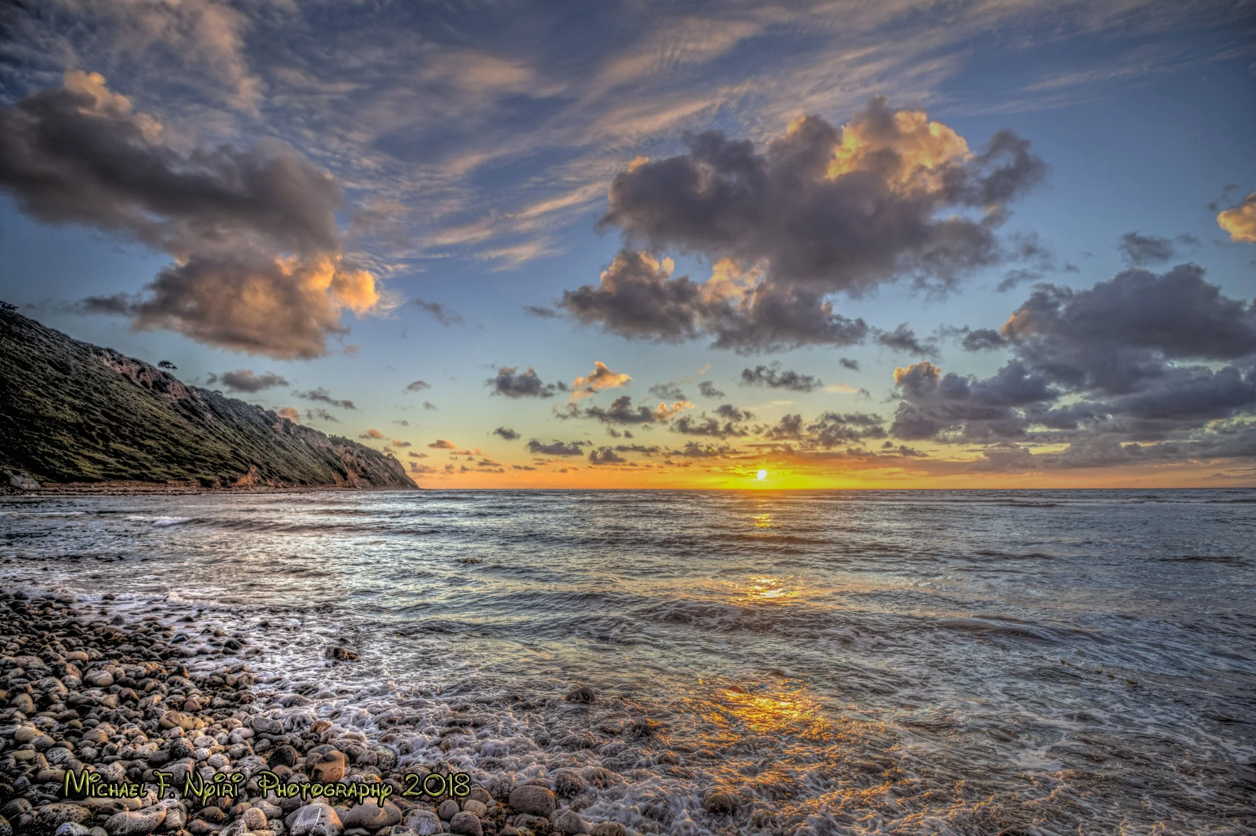
"The Perfect Bluff Cove Sunset" 03-17-2018
Surfers know the area as Palos Verdes Cove, home of the Indicator surf break. The Cove begins at Flat Rock Point, and curves around into Rancho Palos Verdes where Palos Verdes Drive W and Paseo del Mar intersect. There is a small parking lot and amazing views along the "Blufftop Trail". Access to the cove is from Paseo del Mar on the north end. The "Bluff Cove Trail" is moderately inclined on it's way down to the rocky "beach".

"Beach Beauty" 06-11-2017
I've taken some of my favorite photos in and around Bluff Cove over the years. Sunsets can be spectacular. And I like to get right down by the water to get views of the waves crashing against the rocks.
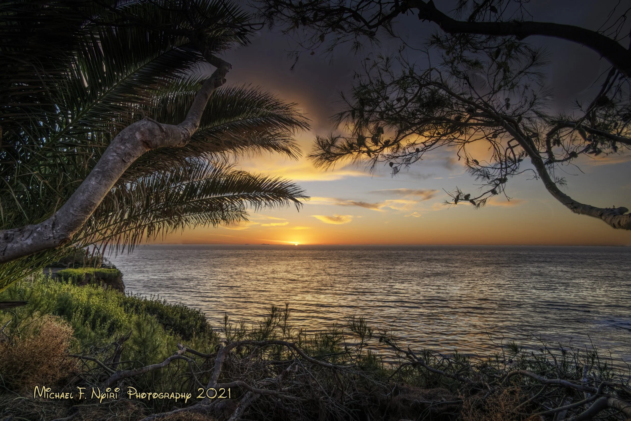
Lunada Bay - Resort Point
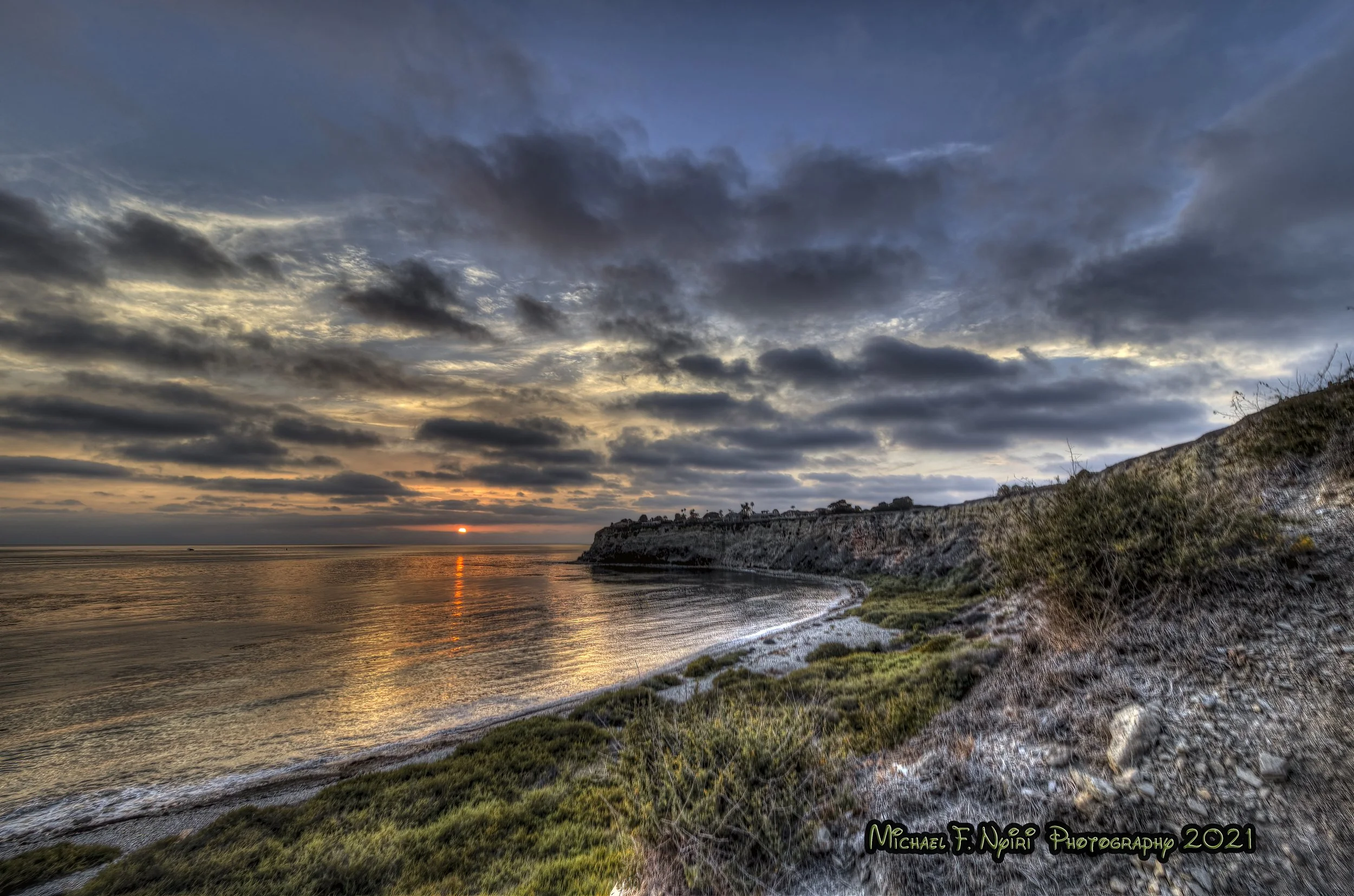
"Approaching Nighttime on the Peninsula" 07-24-2021
Lunada Bay is famous around the L.A. area as being a really "localized" surf spot. I've always known it as a place which can be pretty dangerous to climb down into if not careful, with a terrific canyon (Aqua Amarga) and exquisite sunsets.
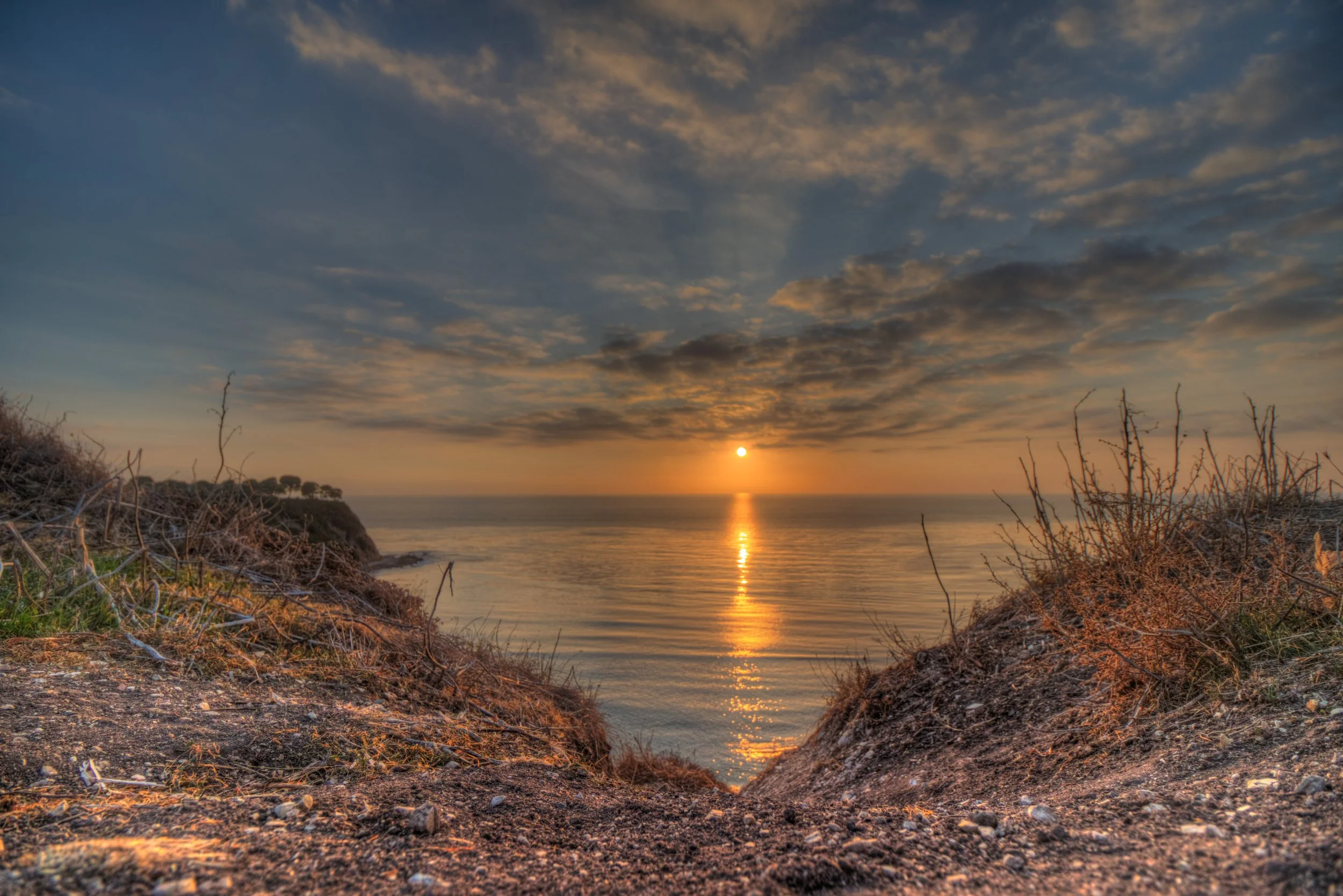
"Crack in the Sunset" 02-10-2018
You can always find lots of cars parked along Paseo del Mar at sunset. The bay begins at Rocky Point. Remains of an old shipwreck, the S.S. Dominator, are at the north end, although not much remains anymore. The south end is at Resort Point.
Honeymoon Cove and Christmas Tree Cove (Crystal Cove)
"The Hidden Coves of the Peninsula " 07-31-2022
I've heard these twin coves called the "hidden coves of Palos Verdes" and I didn't discover them until about five years ago. They're south of Lunada Bay on the other side of Lunada Bay Elementary School, and like Lunada Bay cannot be seen from Paseo del Mar, which ends about mid way between Christmas Tree Cove. I've also heard Christmas Tree Cove called Crystal Cove by locals.
"Enjoying Peninsula Sunsets" 11-30-2021
I do have photographs of the P.V. Coves taken during the daytime, but my favorite time for photographing these natural treasures are during some of our "tropical sunsets" when magic time seems to last forever.
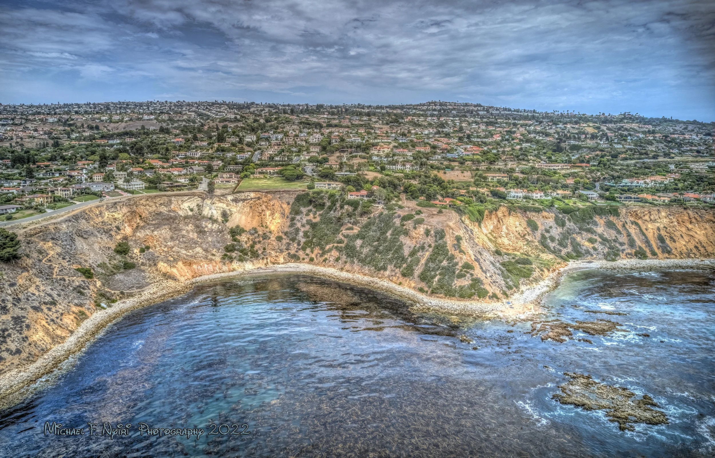
Golden Cove
"On Golden Cove" 12-28-2022
Golden Cove is bordered by Vista Point on the north off Calle Entradero, where you can get to the Vicente Bluffs Reserve trails. I've never attempted to hike down to the water at Golden Cove. (which is marked forbidden by signs along the trail.) However, the walk along the bluffs is leisurely and spectacular.
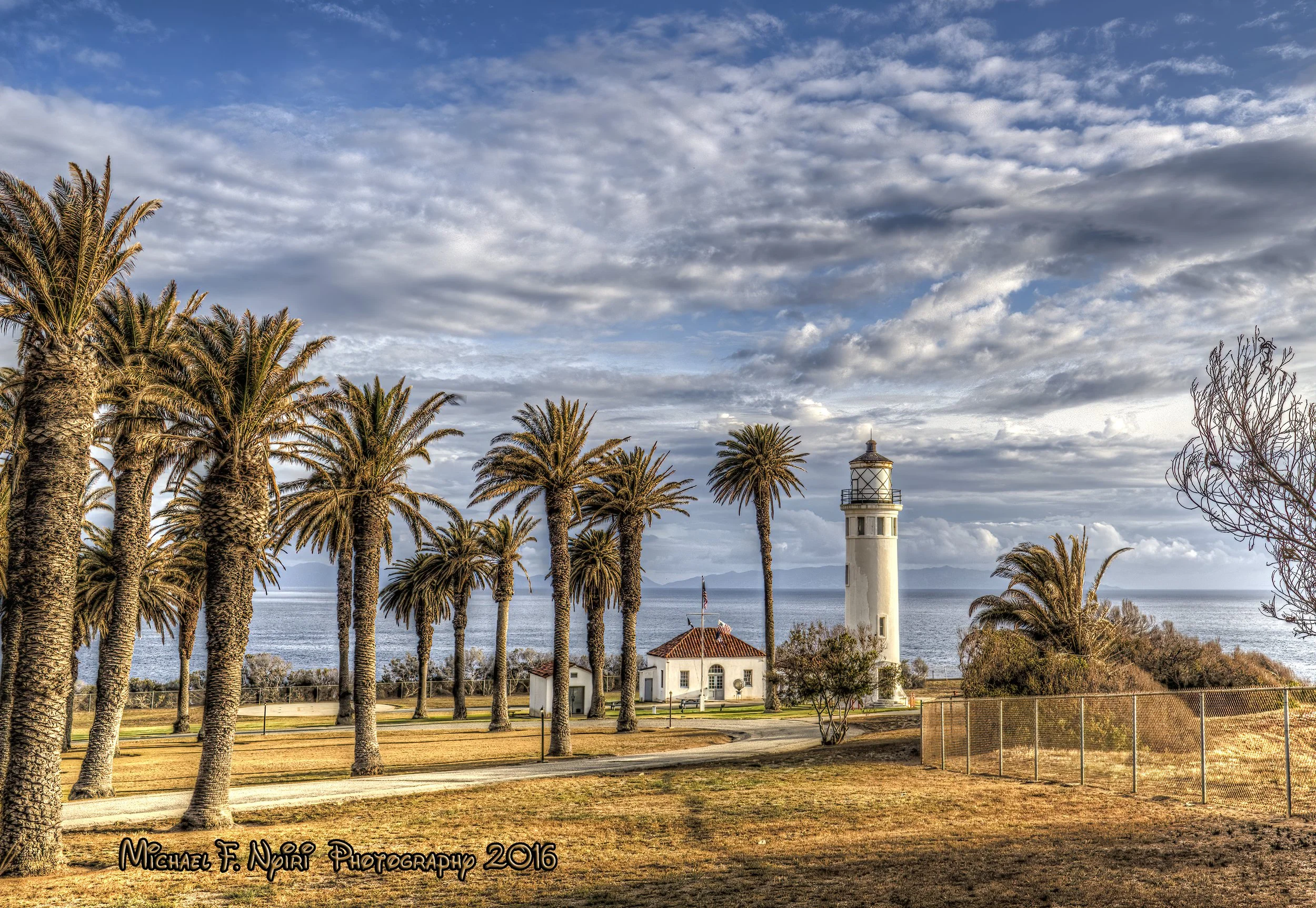
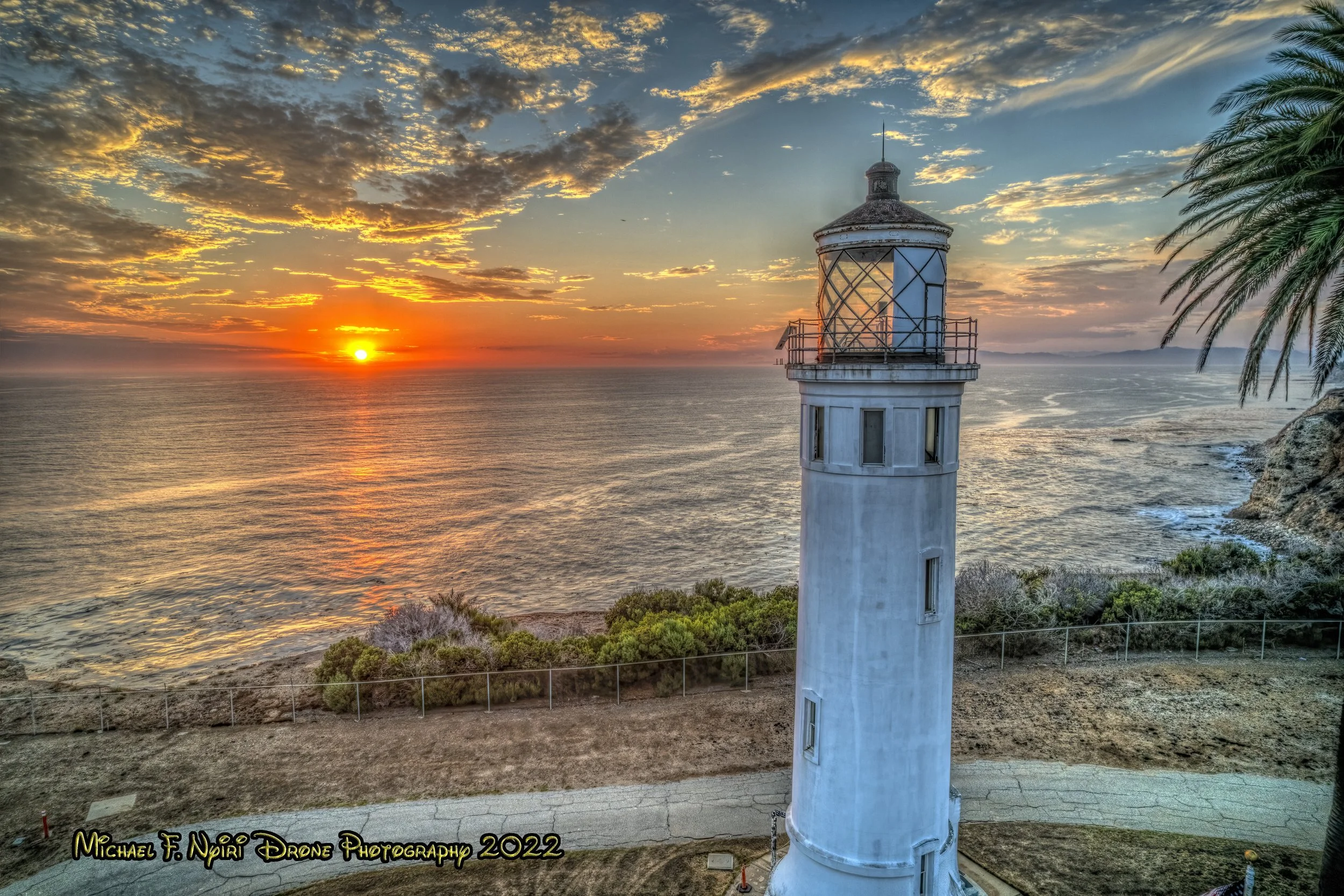
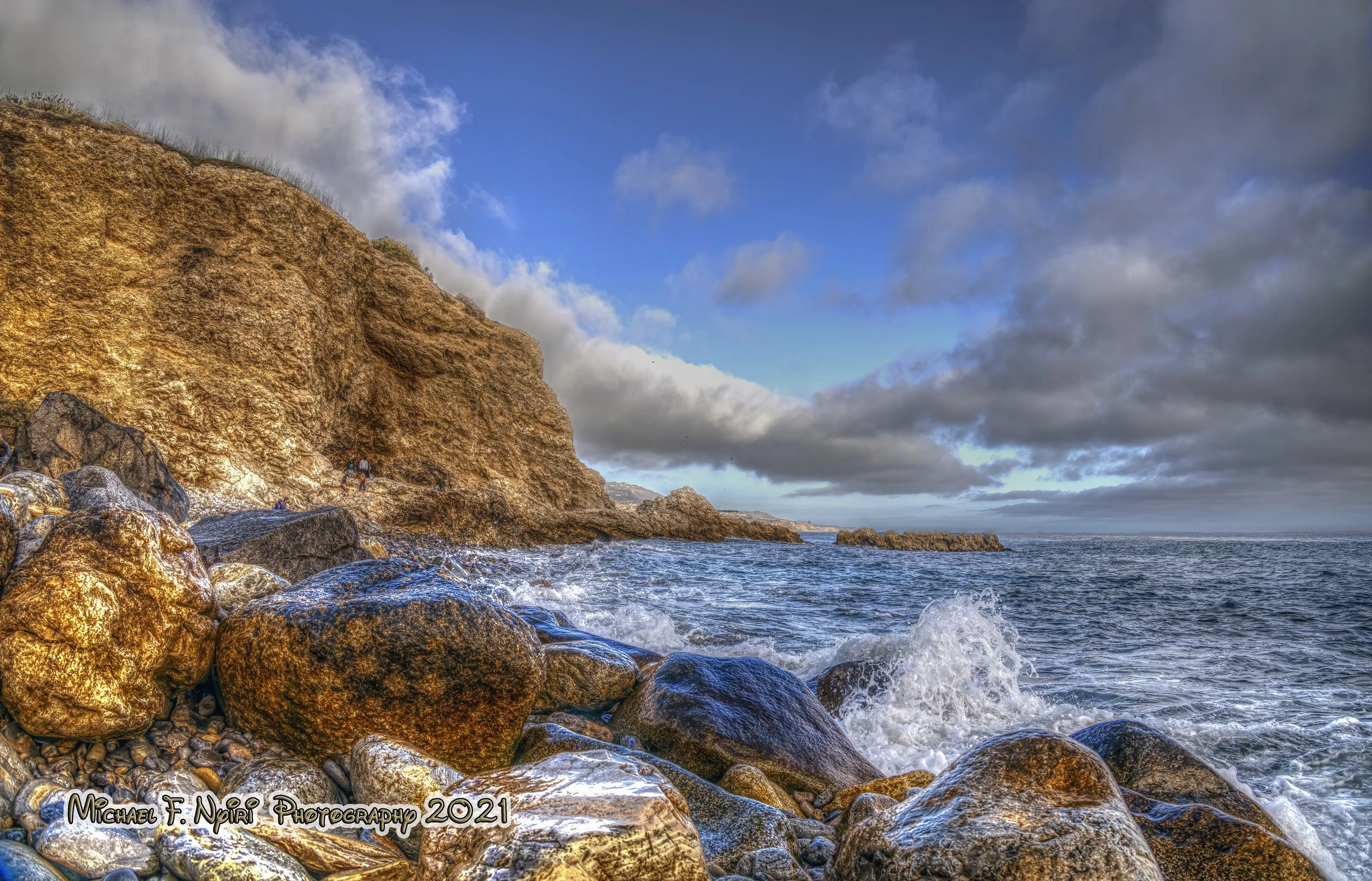
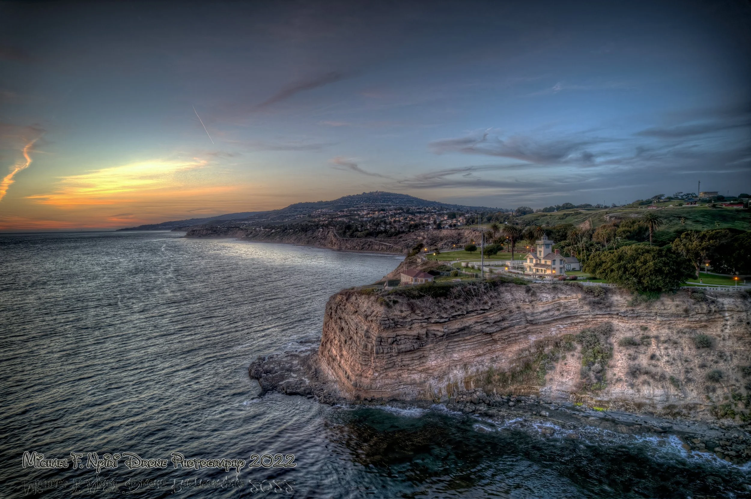
Pelican Cove - Point Vicente
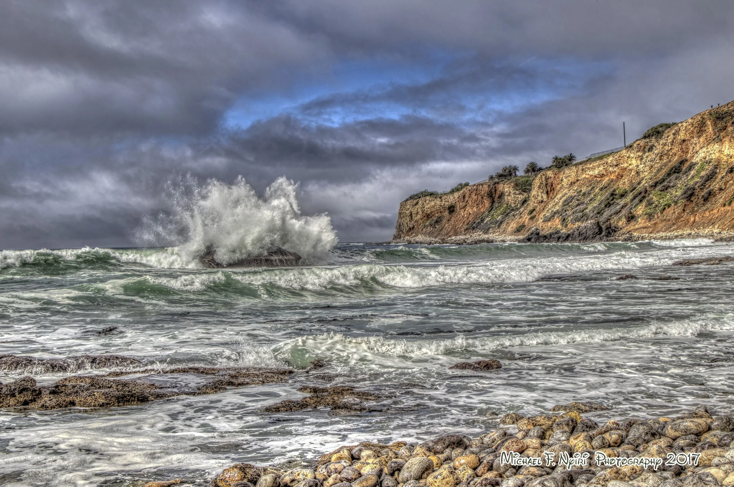
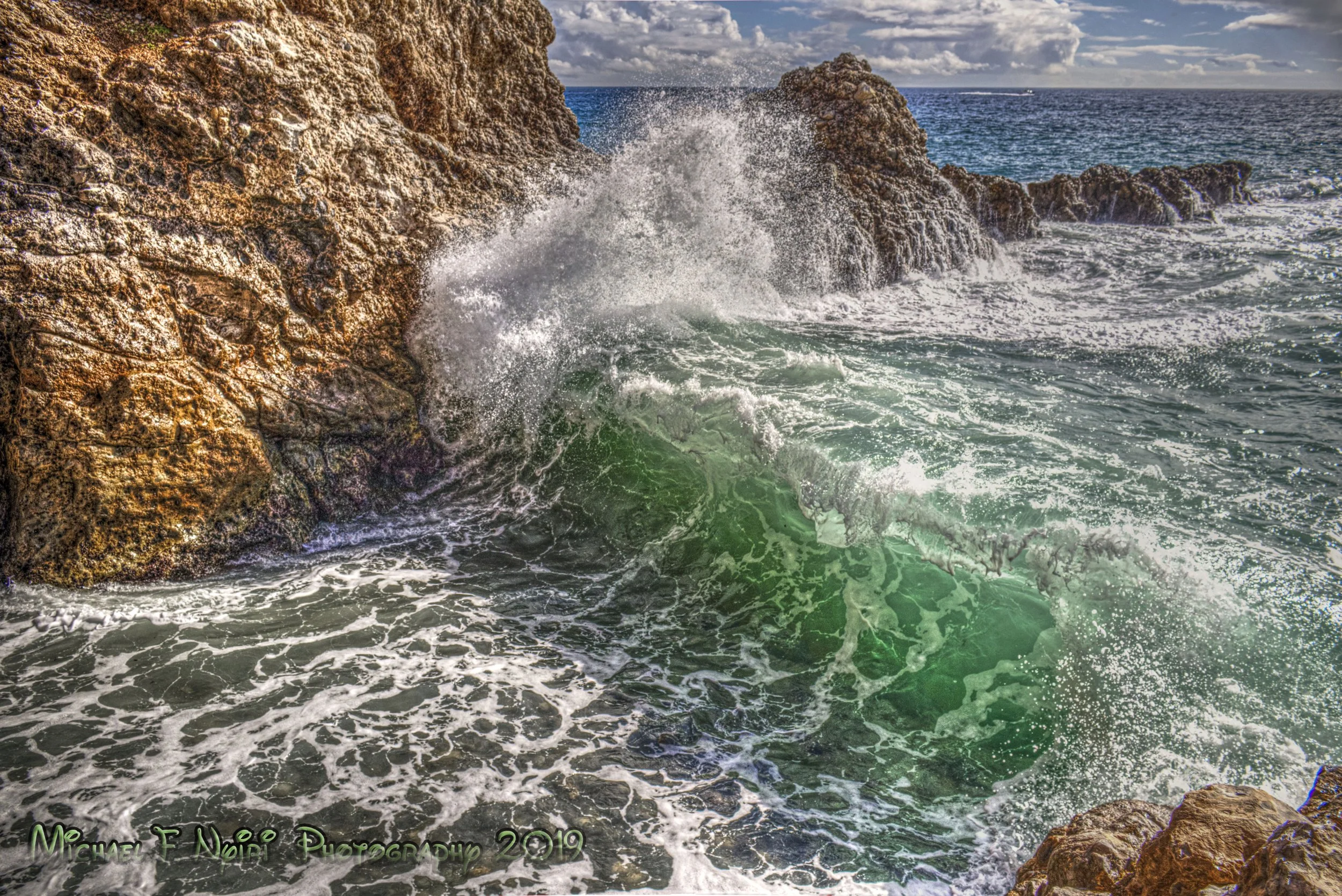
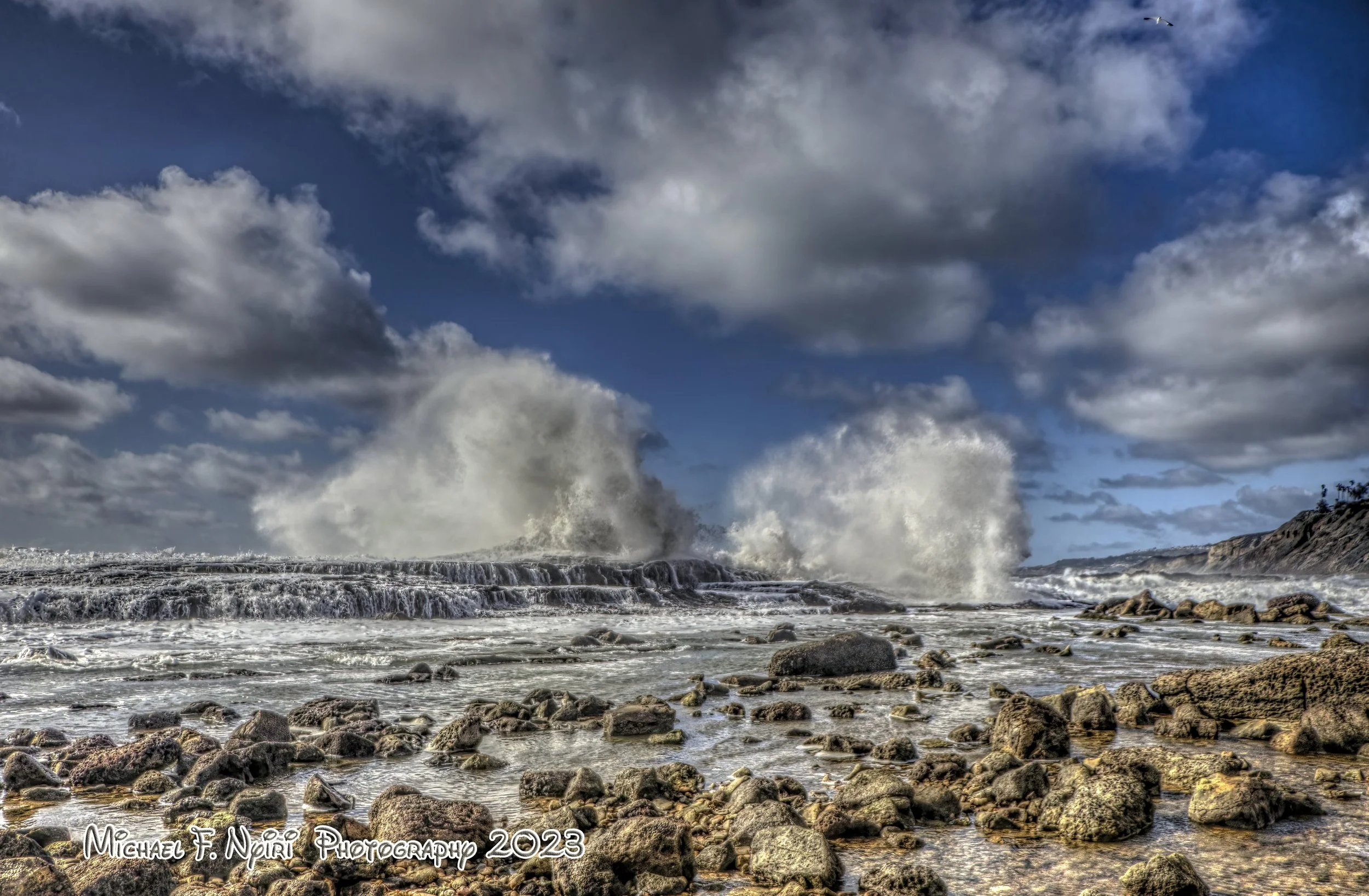
"Wonderful Wave Crash" 02-04-2017
A lot of Palos Verdes' distinctive coves are somewhat "hidden" if you don't know how to get to them, and as noted, some cannot be seen from the street above them. However, Pelican Cove has a parking lot, and is next to the Point Vicente Interpretive Center, and the Point Vicente Lighthouse grounds.
Captain George Vancouver named Point Vicente for his good friend, Friar Vicente of Mission Buenaventura.
"Point Vicente Light at Magic Time " 05-05-2016
The Point Vicente Park is large and accommodating to picknickers and whale watchers. The Interpretive Center has a museum and gift shop. This area is definitely a must see for anyone visiting the Peninsula. Although the actual grounds around the lighthouse are closed by the Coast Guard, they are open to the public on the 2nd Saturday of each month.
"Sunset on the Hottest Day of the Year" 09-04-2022
Pelican Cove, like Bluff Cove, has a relatively flat and easy trail to the ocean, however this one is fairly steep. Access to the point at Toveemur Rock, at the south end of the cove, is off limits because of erosion, like a lot of the points along the California coast. The beach is rocky, with a couple of "paths" but for the most part is known more for tidepooling than sunbathing.
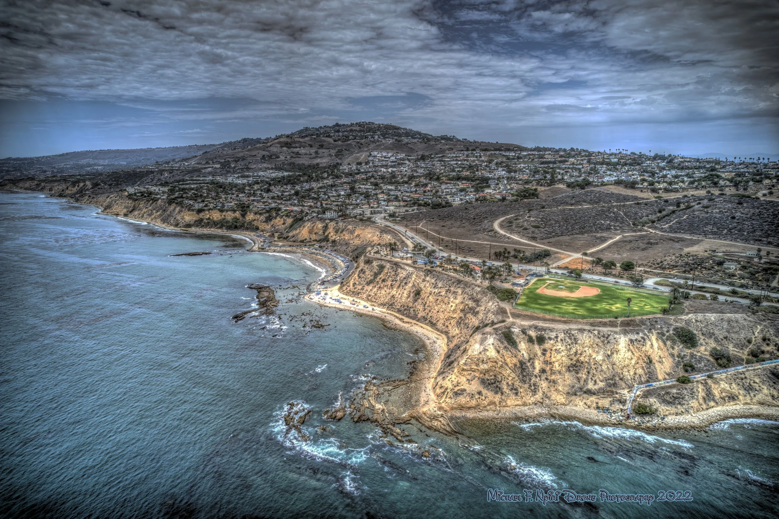
Terranea Cove
"Waterdance " 03-06-2021
The Terranea Trail begins at the southeast parking lot and winds it's way across the Terranea Bluffs to Terranea Beach around the Terranea Resort grounds, which used to be where Marineland of the Pacific stood until it was dismantled after closing in the late 1980s.
It's been a while since I've climbed over the rocky outcropping and into the "Lost Boys" cave at Terranea Beach. This is a sandy beach, although the sandy area is above the rocks. The beach area is public, but is frequented by guests of the resort. There is snorkeling, kayaking, and a line of adriondack chairs for relaxing.
"Terranea Splash" 01-12-2019
I believe there is still a sign warning people to be careful if they climb up and into the cave, which is only accessible at low tide.
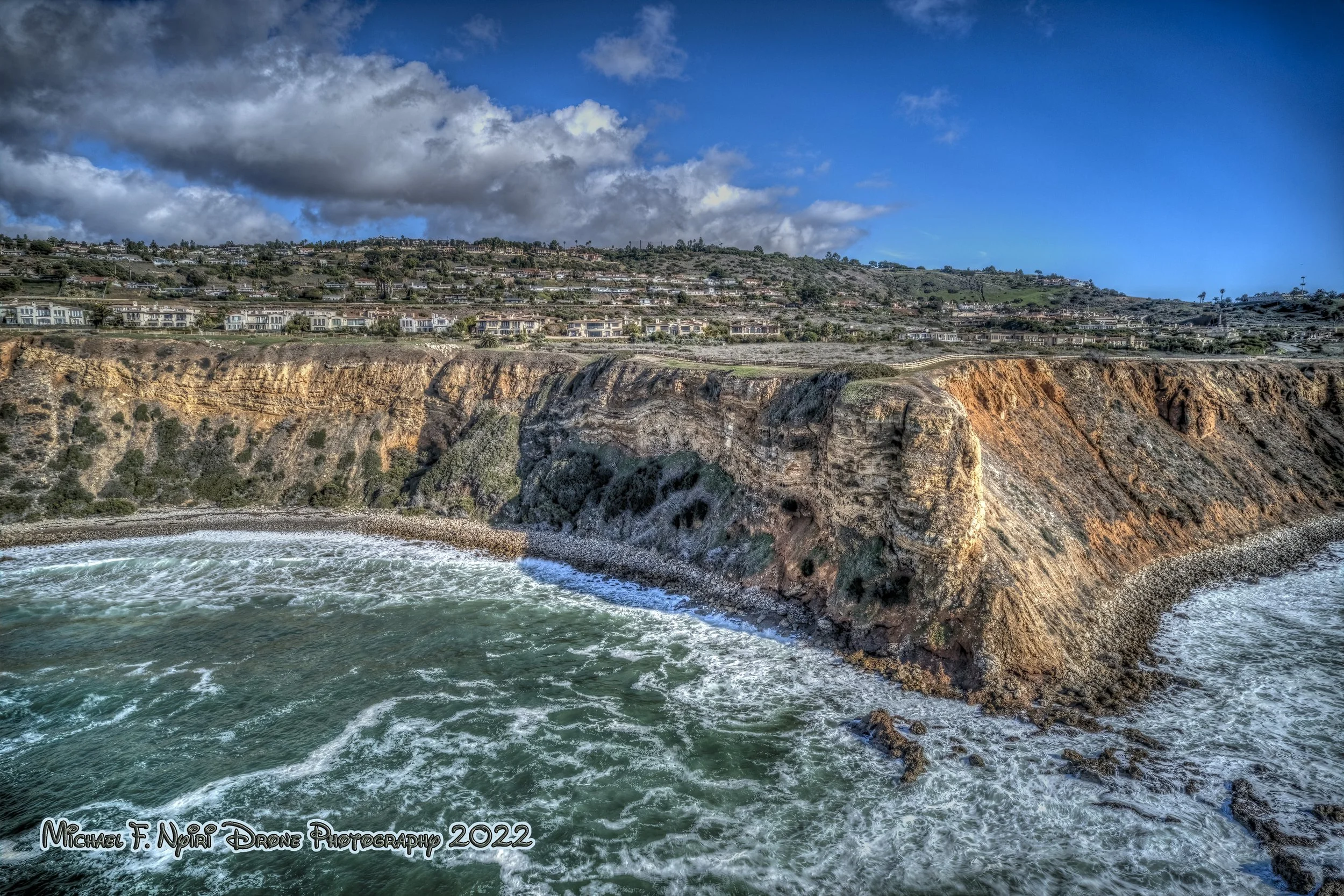
Abalone Cove - Portuguese Point
Abalone Cove is part of the Abalone Cove Reserve and has a metered parking lot (free for seniors and the handicapped). You can get a map to the various trails around both Abalone Cove and Sacred Cove to the east from the staff at the reserve parking lot.
The Cove Reserve covers 109 acres and has swimming, tidal pools and lifeguards. Abalone Cove ends at Portuguese Point, the top of which is accessible from the park trails.
"Sometimes You Just Get Wet" 11-07-2020
Across Palos Verdes Drive S the Wayfarers Chapel looks over Abalone Cove from atop it's hill. The church, affiliated with the Swedenborgian Church of North America, was built by architect Lloyd Wright in 1951. It's a popular spot for weddings and has a rose garden and great views.

"Pointing Toward Heaven" 12-06-2022
Sacred Cove-Inspiration Point
Between the twin points of Portuguese and Inspiration lies Sacred Cove. It's about a 15 minute walk alongside PV Drive to get to the hiking trail down to the Cove, which is clearly marked. Parking is not allowed alongside the road.
"Sacred Cove Tidepools" 01-16-2022
The Cove offers tidepools, fishing, and sea caves.

"What an Inspiration" 07-07-2023
Royal Palms - White Point
"Wonderful White Point" 08-03-2022
There is a plaque in White Point Park which states either the point was named for a sailor named White, who jumped ship and swam to to shore here, or is named because the cliff appears white from sea.
The area we now know as White Point/ Royal Palms, in the San Pedro neighborhood, has a long history, first discovered by Spanish explorers in 1770, becoming part of one of the large rancheros, Rancho San Pedro in 1784, then sold to Jose Dolores Sepulveda, renamed Rancho de los Palos Verdes, and used as a cattle ranch.
In the late 1800s Ramon Sepulveda leased the area to fishermen, and White Point, along with Abalone Cove, became a supplier of abalone, lobster, and crab.
"Cloud Kiss" 01-16-2023
After the discovery of thermal hot springs in 1917, a resort was built by Sepulveda and the Tagami brothers, with a bathhouse, two story hotel, restaurant, boating area and salt water plunges. The 1933 eathquake stopped the flow of sulfer water, and all the Japanese on the Peninsula were evicted and sent to internment camps after the bombing of Pearl Harbor. The hotel complex was destroyed and White Point became part of the coastal defense system at Fort MacArthur.
The only remant of the spa now is the concrete around the palm trees at the Royal Palms end of the beach.
"When Blue Turns to Gold" 11-18-2017
White Point has a park on the bluff with restrooms, a play area, and picnic tables. The beach area below the bluff has metered parking, tidepools, and another picnic area over by the palms. There is also a neat little trail above which leads above the Royal Palms area.
The beach is rocky, but there is a sandy strip and lots of parking. Fishing, scuba diving and surfing are encouraged. It isn't recommended as a swimming beach because of the rocky shoreline.
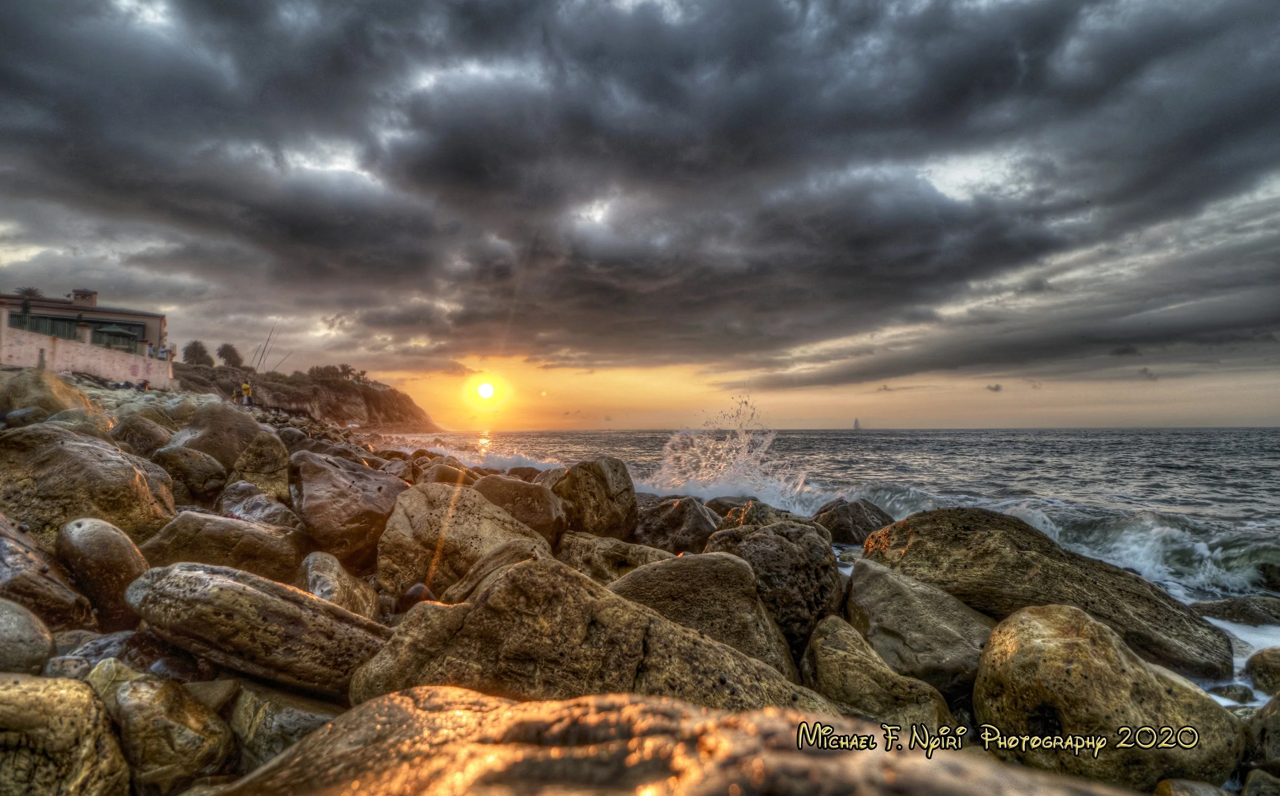
Point Fermin - Cabrillo Beach
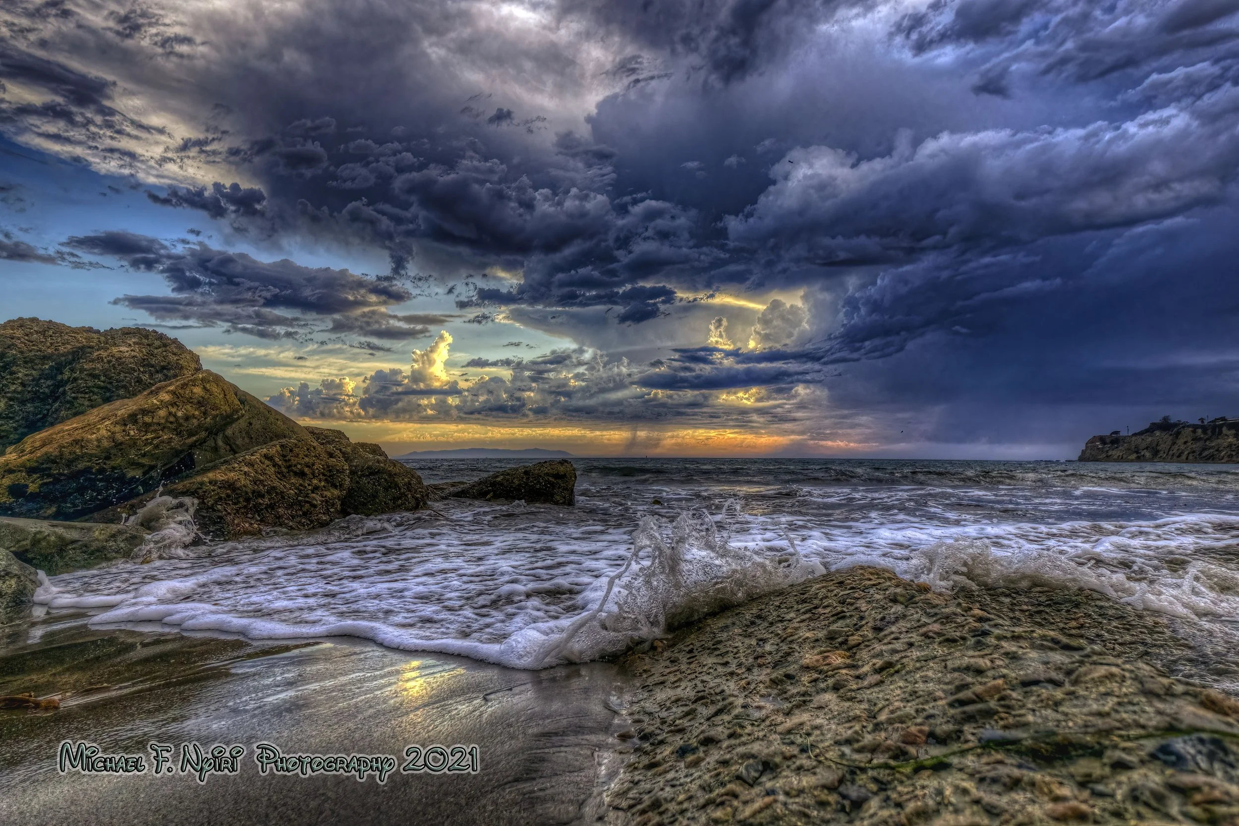
"Stormy Skies" 10-04-2021
The southernmost point in Los Angeles, located in San Pedro (which is not a city but an L.A. neighborhood since 1909), Point Fermin is last point on the Peninsula.
Point Fermin Park has lots of amenities, and is home to the Point Fermin Lighthouse, a decorative Victorian Stick Style building designed in 1874 by architect Paul Pelz.
There are covered picnic tables, a band shell, lots of walking and hiking trails, and Angel's Gate Park, home of Korean Friendship Bell is across the street on the hill above the park.
I've had conversations with lots of folks on my local "Photo Expeditions" around the Peninsula, and we all agree. It's one of the true treasures of all of California, and is a blessing to live in or around.
"Peninsula Dreamtime" 02-26-2022
Michael Nyiri is an active single amateur photographer. He moved to the South Bay in 1975 after college and has lived in numerous apartments in locations ranging from Hermosa Beach to Long Beach. Living in Harbor City for the past 14 years, he calls the Palos Verdes Peninsula his backyard.
Practicing an artistic method of photography called HDR (high dynamic range), his images are always photographed from interesting angles, including low to the ground and, thanks to his drone, from high above.
The HDR style of "artistic photography" entails taking three exposures with a high speed shutter, and combining them in computer programs to bring light out of the shadows, and color to the forefront.
Interested in art and photography from a young age, Michael began to refine his digital photography skills later in life, in 2015, at the age of 62. He goes on what he calls "Photo Expeditions"
Now retired from a 34 year career as an electrical control panel designer, Michael spends most of his time traveling and taking photos. He posts daily on a variety of social media platforms and sells prints and merch on his personal website.